Wetlands Delineation & Permitting
Individual landowners and developers embarking on construction projects that might affect wetlands, streams, or other water bodies, or those aiming to minimize impacts on these areas, often require expert assistance to comply with the Clean Water Act (CWA) and related state or local regulations.
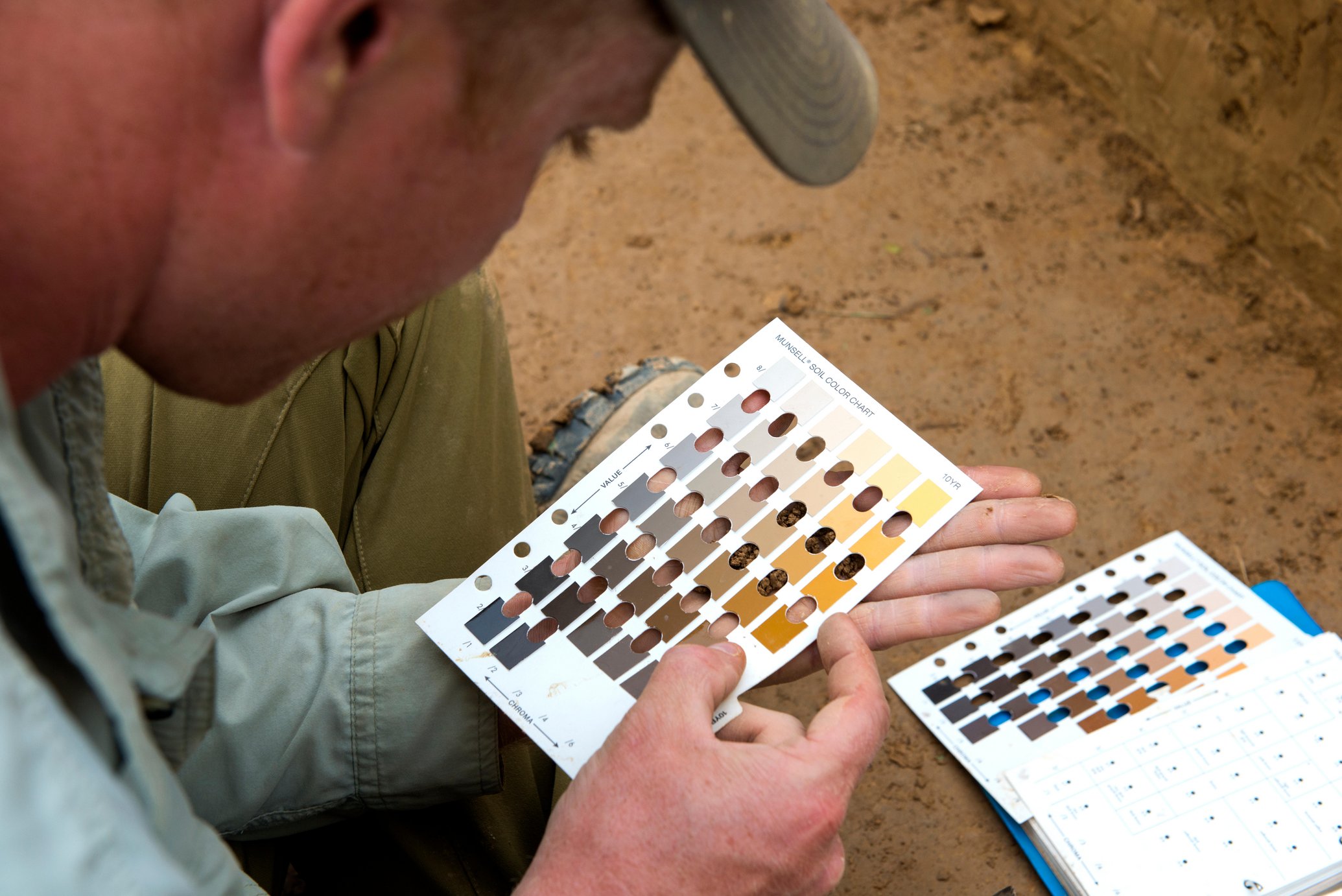
Wetland delineation is the process of identifying, characterizing, and mapping wetlands on a property. This process involves a combination of fieldwork, data analysis, and consultation with regulatory agencies. During the fieldwork, experts evaluate the site’s characteristics, including soil type, vegetation, hydrology, and topography. These characteristics can indicate the presence of wetlands. Experts use indicators of hydrology, hydric soils, and hydrophytic vegetation to identify the presence of wetlands. They then map and document the boundaries of the wetlands on the property.
Riverbend Environmental offers a suite of services designed to help landowners and developers identify environmentally sensitive areas, thereby avoiding costly errors such as encroaching on stream buffers or disturbing wetlands.
At Riverbend Environmental, we have a proven track record in identifying state waters, stream buffers, and wetlands for various projects. It’s not impossible to build in or develop an area that contains wetlands, but the permitting process can get complicated – and for good reason. Regulations are in place because those bogs, marshes, fens, and swamps play a vital role in flood control and maintaining water quality, and we’re losing thousands and thousands of acres yearly, according to the EPA.
Frequently Asked Questions
If you have additional questions reach out and a team member will get in touch with you.
The U.S. Army Corps of Engineers (USACE) has developed the Wetlands Delineation Manual, a set of guidelines used to identify and classify wetland areas. Generally, identifying potential wetlands is straightforward based on certain characteristics:
- Typically, these lands are either flooded or have saturated conditions due to surface or groundwater, making the area noticeably wet or muddy.
- They support vegetation that thrives in wet environments.
- The soil in these areas exhibits signs of being water-saturated.
While the designation of an area as a wetland might impose certain limitations on property owners, the ecological and environmental importance of wetlands is significant, particularly in terms of flood management.
Wetland delineation is a critical process for identifying, characterizing, and mapping wetlands within a specific property. This procedure combines on-site fieldwork, thorough data analysis, and consultations with regulatory bodies. During field assessments, specialists examine various site features such as soil types, vegetation, water sources, and the landscape’s shape. These elements help in detecting the presence of wetlands. Key indicators like water presence, water-loving soils, and aquatic plants are used to confirm wetland areas. Following this, the experts delineate and record the wetland boundaries on the property.
For developers or project managers, navigating the complexities of wetland delineation can be daunting. Here are some considerations to simplify your understanding:
Navigating Complex Regulations: Wetland delineation and permitting involve intricate regulations. Collaborating with a consultant who is well-versed in regulatory compliance and environmental permitting is essential for guidance through this complex process.
Expertise is Key: Given the specialized nature of wetland delineation, enlisting the help of experienced professionals ensures a more accurate and reliable identification of wetland boundaries, reducing uncertainties in your project.
Managing Time Effectively: Adhering to project timelines is crucial, and delays can be costly. Utilizing the latest technology and methods can enhance the efficiency and precision of the delineation process, helping to keep your project on schedule.
Avoiding Delays and Interruptions: Unidentified wetlands can lead to unexpected project hold-ups, especially during the permitting phase. Proper delineation helps in foreseeing and avoiding such setbacks.
Cost Implications: While it may seem like an added expense, investing in thorough wetland delineation can ultimately lead to significant cost savings by preventing disruptions and additional costs that arise from disturbing undetected wetlands during your project.
If wetland characteristics are identified, the wetland’s boundaries are marked with stakes or flagging. These boundaries are then surveyed and mapped, and a Wetland Delineation Report is created. This report includes a summary of the site, scientific data, wetland rating, and a detailed map showing both the wetland areas and any proposed developments, along with their buffers.
Wetlands are increasingly recognized as valuable assets, and the U.S. Environmental Protection Agency (EPA) strives to reduce or eliminate negative impacts on these ecosystems whenever feasible. However, there are instances where impacting wetlands is unavoidable, such as during essential projects like roadway improvements for enhanced safety. In cases where wetlands near existing infrastructure are impacted, the EPA advocates for “compensatory mitigation” to counterbalance the ecological loss in the watershed. This mitigation can take various forms:
- Restoration: This involves restoring or rehabilitating wetlands that have been previously degraded or altered, bringing them back to their natural state.
- Establishment: This refers to the creation of new wetland areas where none existed before, to compensate for the loss of natural wetlands.
- Enhancement: This method focuses on improving the quality and functionality of existing wetlands, making them healthier and more robust.
- Preservation: This approach involves implementing legal and physical measures to protect and maintain the integrity of existing wetlands and their ecosystems.

